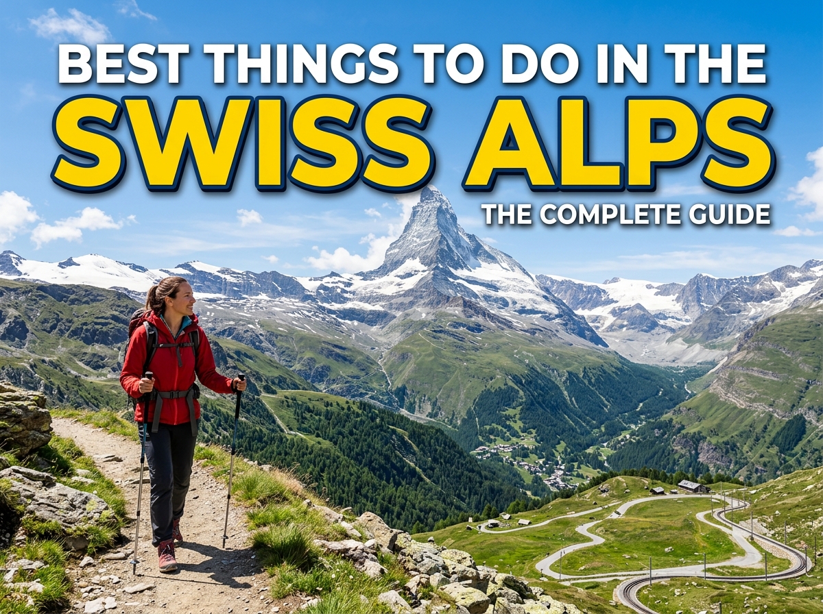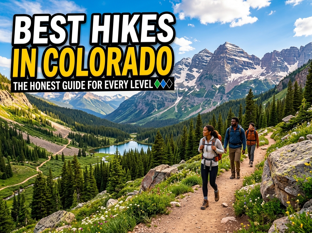
This guide covers the best hikes in Colorado organized by difficulty, with honest assessments of what makes each one hard or easy, which ones need permits, and the practical details most other guides skip entirely.
Before listing a single trail, there is one topic that every guide glosses over and that causes more ruined trips than anything else.
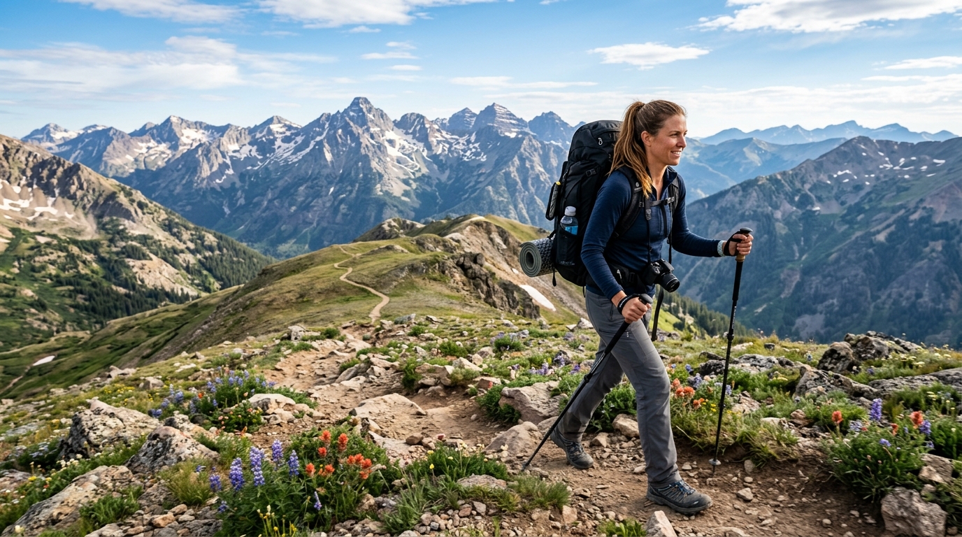
Altitude affects you even if you are fit.
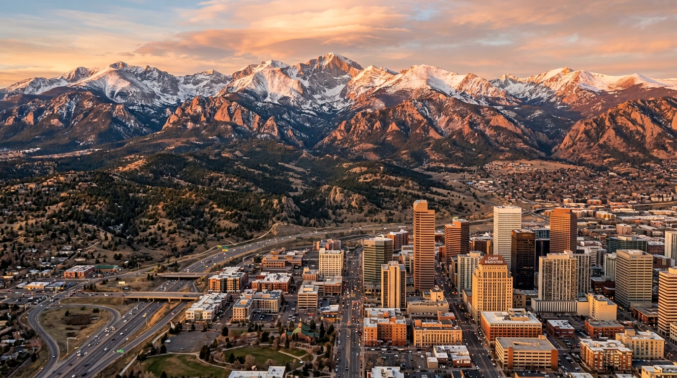
Denver sits at 5,280 feet above sea level, which is already higher than most cities in the world. Most Colorado trailheads start between 8,000 and 11,000 feet. Many alpine hikes reach 13,000 to 14,000 feet at their highest point. If you are flying in from anywhere near sea level, your body needs time to adjust before you push it hard.
Symptoms of altitude sickness include headache, fatigue, nausea, and shortness of breath that feels disproportionate to your effort. It can affect anyone regardless of fitness level and does not discriminate based on how much you exercise at home.
What to do: Spend at least one full day in Denver or another lower elevation area before attempting anything above 10,000 feet. Drink more water than usual, avoid alcohol the first couple of days, and start with an easier, shorter trail before committing to a long alpine hike. If symptoms feel serious, descend. Altitude sickness does not improve at elevation.
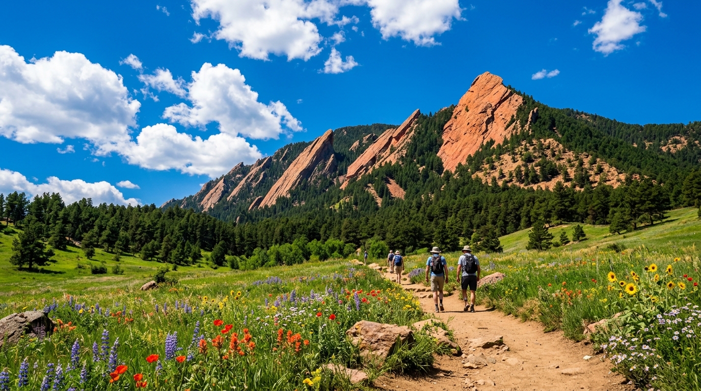
Distance: 2 to 5 miles depending on route | Elevation Gain: 500 to 1,800 feet | Difficulty: Easy to Moderate
The Flatirons are the slanted sandstone rock formations that frame Boulder against the Rockies, and hiking up toward them on the Chautauqua Trail is one of the best introductory Colorado experiences you can have. The lower Chautauqua Loop is genuinely easy, through rolling meadows full of wildflowers in summer. Push higher toward Bluebell Shelter or the Royal Arch trail and the difficulty increases significantly but so do the views.
The trailhead is in the Chautauqua Park neighborhood, about a mile from downtown Boulder. Parking gets busy on weekends. A free shuttle runs on summer weekends from downtown, which is the easiest option if you are coming from outside Boulder.
This is a great first Colorado hike. It introduces you to higher elevation without overwhelming you, and it gives you a real feel for what Colorado’s Front Range looks like up close.
Distance: 0.8 miles | Elevation Gain: 70 feet | Difficulty: Easy
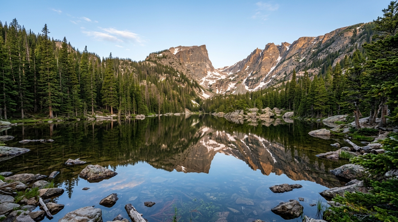
Bear Lake is one of the most accessible and beautiful spots in Rocky Mountain National Park, a short paved loop around a mountain lake with views of the surrounding peaks that look almost painted. The loop itself is flat and short enough for almost any fitness level.
The trailhead is extremely popular and requires a timed entry permit for the Bear Lake Road corridor between late May and mid-October. Book through Recreation.gov well in advance, sometimes weeks ahead in peak summer. Arriving without a permit during that window means being turned away at the park entrance.
From Bear Lake, you can extend the hike to Nymph Lake, Dream Lake, and Emerald Lake for progressively better views and a few more miles without the trail ever getting truly difficult. Dream Lake is one of the most photographed spots in the entire state for good reason.
Distance: 4.4 miles round trip | Elevation Gain: 1,100 feet | Difficulty: Easy to Moderate
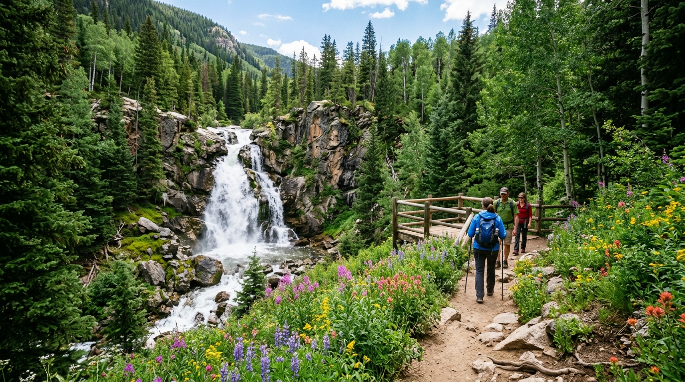
Most people know Vail as a ski town, but this trail above the valley in summer is genuinely excellent. You hike through wildflower meadows, gain just enough elevation to feel accomplished, and reach a waterfall at the turnaround point. The wildflowers in July are particularly good here, with fields of lupine, columbine (Colorado’s state flower), and Indian paintbrush lining the trail.
Parking at the trailhead is limited and fills early on summer weekends. Arrive before 8am or plan on adding a walk from the town parking.
Distance: 9.4 miles round trip | Elevation Gain: 1,780 feet | Difficulty: Moderate
Sky Pond is one of the best hikes in Rocky Mountain National Park and arguably in the entire state. The trail passes through Glacier Gorge, past Alberta Falls, and continues climbing through increasingly dramatic alpine terrain to a series of lakes. The final approach to Sky Pond involves scrambling up a short but steep waterfall face, which adds a genuine moment of adventure to the day.
This hike requires a timed entry permit for the trailhead from late May through mid October, just like Bear Lake. Book through Recreation.gov. Starting before 6am gets you ahead of the permit requirement on some access points, which is also when the light on the peaks is at its best.
By September, the waterfall section can be ice-covered and significantly more dangerous. Know the conditions before you go.
Distance: 8 miles round trip | Elevation Gain: 1,100 feet | Difficulty: Moderate
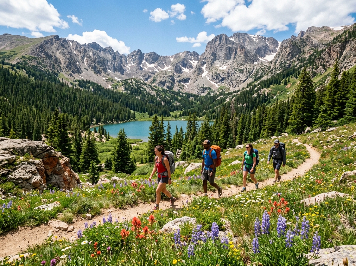
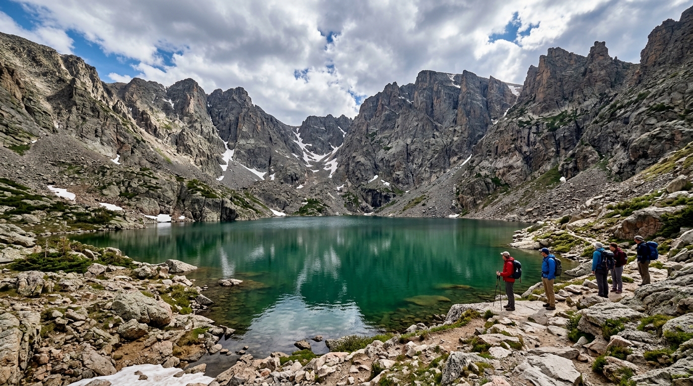
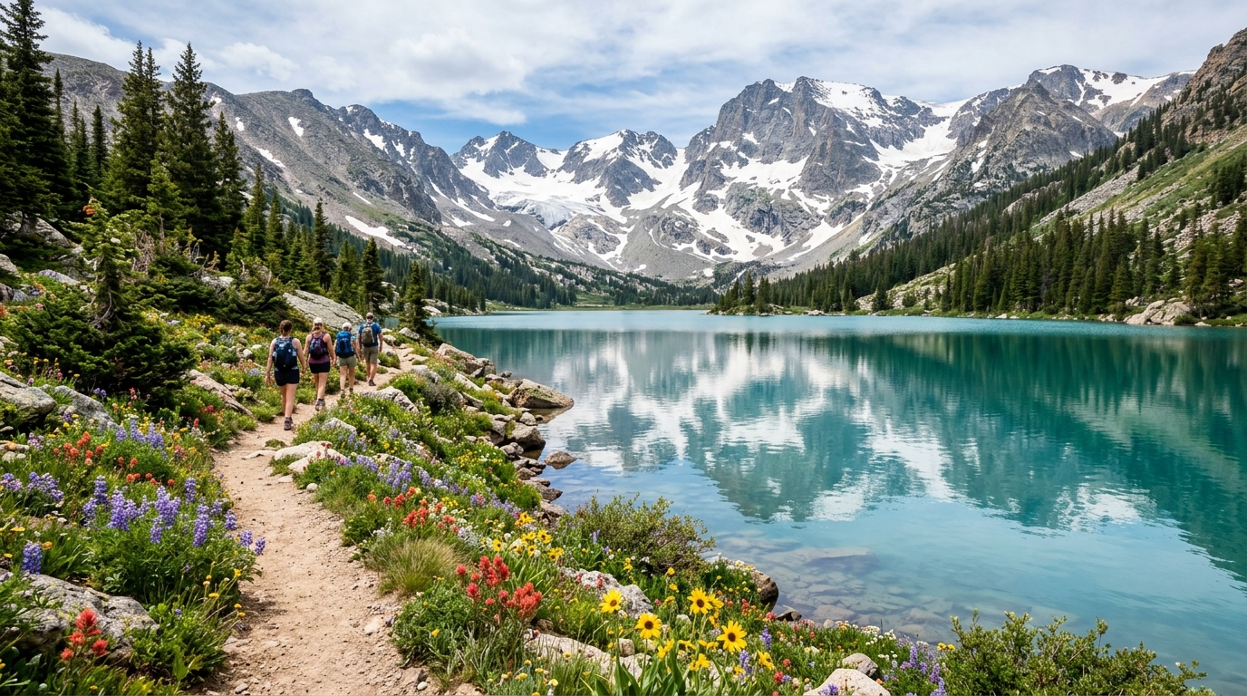
The Indian Peaks Wilderness outside Ward, about 45 minutes from Boulder, contains some of the best moderate hiking accessible from Denver without driving to Rocky Mountain National Park. The trail to Lake Isabelle starts at Brainard Lake, passes Long Lake, and arrives at a stunning alpine lake backed by the Continental Divide.
Brainard Lake Recreation Area requires a timed parking reservation from late June through mid September. Book through Recreation.gov. The fee is separate from a National Park pass.
The trail is mostly gradual and accessible to reasonably fit beginners, though the elevation sits around 11,000 feet throughout, so altitude awareness matters. A great first visit to this area is starting from Brainard Lake itself for a flat warm up around the reservoir before committing to the full trail.
Distance: 3.6 miles round trip | Elevation Gain: 500 feet | Difficulty: Easy to Moderate
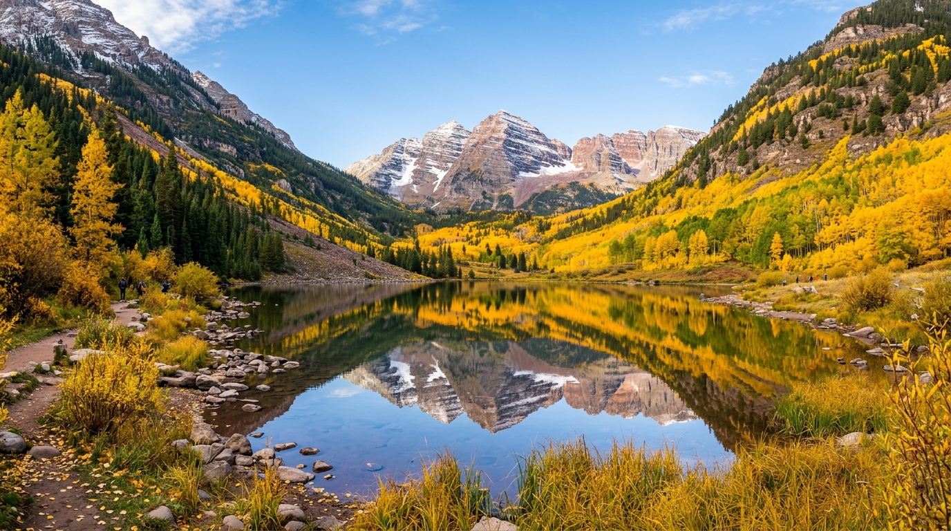
The Maroon Bells are the most photographed mountains in Colorado, twin 14,000 foot peaks reflected in Maroon Lake below them that appear on more postcards than any other landscape in the state. The short hike to Crater Lake adds depth to the visit, taking you past the lake and up through aspen groves to a higher viewpoint.
Getting here requires either arriving before 8am during peak season or taking a mandatory shuttle from Aspen Highlands. The shuttle runs from late June through mid October. No private vehicles are allowed past the gate during those hours. Book shuttle tickets in advance.
The Maroon Bells area is magnificent in fall, when the aspen trees turn gold, typically mid to late September. This is the most popular period to visit and advance planning is essential.
Distance: 7 miles round trip to lower Blue Lake, 9 miles to upper lake | Elevation Gain: 2,500 feet | Difficulty: Hard
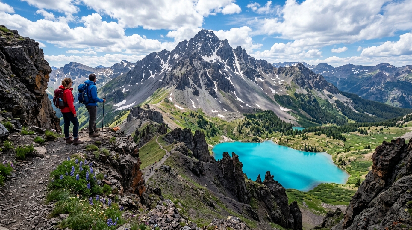
The San Juan Mountains in southwestern Colorado are the most dramatic range in the state, with jagged peaks that look completely different from the rounded Front Range mountains near Denver. Blue Lakes sits below Mount Sneffels in the Uncompahgre Wilderness, and the lower lake is one of the most visually stunning destinations in Colorado, turquoise water set against dark volcanic cliffs.
The hike itself involves sustained climbing and puts you above 12,000 feet at the lower lake and above 13,000 at the upper. For fit hikers wanting an additional challenge, the scramble to the summit of Mount Sneffels adds roughly 2,000 more feet and takes you to 14,150 feet, but requires comfort with exposed terrain and loose rock.
Peak hiking season here is mid July through mid September. Snow can persist on the upper sections well into summer, and afternoon thunderstorms are particularly common and fast moving in the San Juans. Start hiking by 6am and plan to be descending from any exposed ridge or summit by noon.
The nearest towns are Ridgway, Ouray, and Telluride, all worth building into a longer trip to this part of the state.
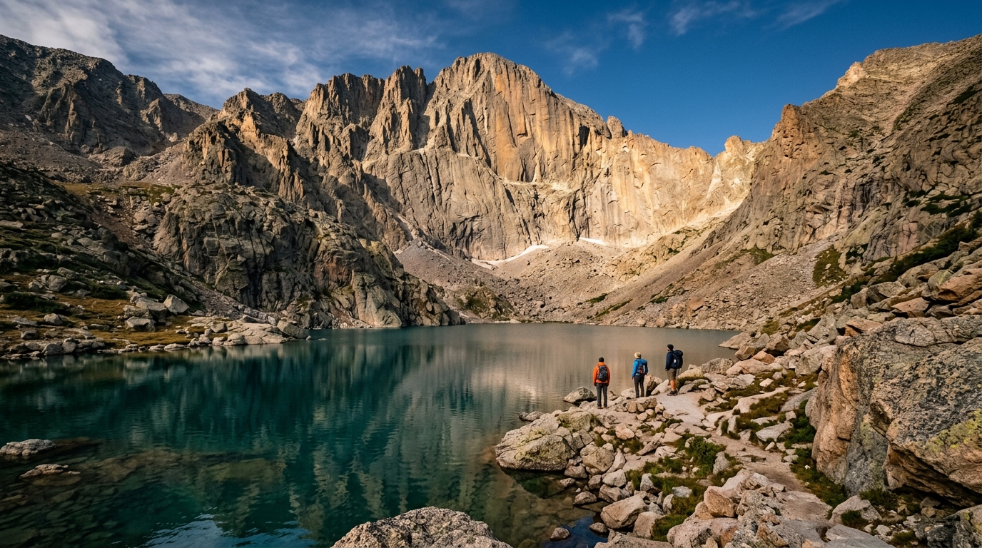
Distance: 13 miles round trip to Chasm Lake | Elevation Gain: 2,700 feet | Difficulty: Hard
This trail begins at the Longs Peak Trailhead in Rocky Mountain National Park and climbs toward the base of Longs Peak, the tallest mountain in the park at 14,259 feet. Most hikers turn around at Chasm Lake, a glacially carved lake sitting directly beneath the dramatic vertical east face of Longs Peak. The views here are some of the most dramatic in Colorado.
The trailhead sits at 9,400 feet and the lake is just above 11,800 feet. Because Longs Peak itself draws hikers attempting the full summit, the trailhead starts before dawn most summer mornings. For Chasm Lake, starting between 4 and 6am gives you the best light and avoids the afternoon thunderstorm window.
No permit is required for Chasm Lake specifically, though park entry fees apply. The full summit of Longs Peak requires technical scrambling on the Keyhole Route and is beyond a beginner or intermediate experience.
Colorado’s mountains generate severe afternoon thunderstorms from late spring through early fall. This is not occasional. It happens consistently, almost daily in July and August, and it is the single most important safety consideration for hiking above treeline.
Lightning at elevation is extremely dangerous. Being on an exposed ridge or summit when a storm rolls in puts you in serious risk.
The rule that most experienced Colorado hikers follow: be below treeline by noon, and at or near your trailhead by 1 or 2pm in thunderstorm season. This means starting early. Very early. Trailheads for popular alpine hikes in summer regularly have cars parked at 5 and 6am.
If you see dark clouds building over the peaks, do not wait to see what happens. Begin descending immediately regardless of how close you are to your destination.
This is the section most guides skip because it complicates the “just go hike” message. The reality is that several of the most popular Colorado trailheads now require advance reservations, and showing up without one during peak season means getting turned away.
Trailheads and areas currently requiring timed entry or parking reservations include:
The Bear Lake Road corridor and Longs Peak Trailhead in Rocky Mountain National Park from late May through mid October. The Maroon Bells area near Aspen from late June through mid October. Brainard Lake Recreation Area near Ward from late June through mid September. Hanging Lake in Glenwood Canyon (reservations required year round, and spots fill months in advance).
Check Recreation.gov and individual park websites for current requirements before your visit. These systems change, and requirements that did not exist two years ago now apply to trails that are on this list.
Colorado is a welcoming state for solo female hikers, with busy, well trafficked trails that make solo hiking comfortable on most popular routes. A few practical things worth knowing.
Download your trail on AllTrails before you leave cell service. Many Colorado trailheads lose signal within the first mile. Having an offline map you can use without data is the difference between a navigational annoyance and a real problem.
Tell someone where you are going and when you expect to be back before you leave. This is standard hiking safety advice that matters more in Colorado’s remote areas, particularly anything in the San Juans, which are several hours from the nearest hospital.
A personal locator beacon is worth carrying on any longer or more remote trail. These small devices send an emergency signal even without cell service. This compact GPS emergency communicator on Amazon pairs with an app on your phone and lets you send a location and message even without cell coverage, which matters enormously on Colorado’s more remote trails.
On well trafficked trails near Denver and in Rocky Mountain National Park, solo hiking feels comfortable and trails are rarely completely empty during daylight hours in peak season. On more remote hikes in the San Juans or Indian Peaks Wilderness, you may cover miles without seeing another person, which changes the preparation calculus.
Colorado’s weather changes fast. The morning can be warm and sunny, and by early afternoon a thunderstorm can drop the temperature 20 degrees and bring lightning, hail, and rain. Packing for this is not optional.
Layers always. A waterproof jacket fits in any daypack and is the single most important item you can carry for mountain hiking. Sunscreen matters more than people expect at elevation, since UV exposure increases significantly above 8,000 feet. Sunglasses with UV protection are equally important, especially on trails with snowfields.
Trekking poles make a significant difference on both the ascent and descent of steeper trails, particularly for anyone whose knees feel the downhill. These collapsible lightweight trekking poles on Amazon pack down small, adjust easily, and handle both rocky terrain and snow without feeling cumbersome.
Water requirements are higher than most people expect. Aim for at least half a liter per hour of hiking, more in summer heat or above 11,000 feet. Many Colorado trails have streams and lakes along the route, but treat all backcountry water with a filter before drinking.
High quality hiking shoes with ankle support make a genuine difference on rocky alpine terrain. Trail runners work well for easier, well maintained trails. For anything involving loose rock, scree, or scrambling, more structured footwear with real grip and ankle support is worth the investment.
June through early July is when lower elevation trails are at their greenest, with wildflowers and high water from snowmelt making waterfall and river trails particularly beautiful. Higher alpine trails may still have significant snow coverage through June.
Mid July through August is peak season. Most alpine trails are fully snow free, temperatures are warm at lower elevations, wildflowers are everywhere, and crowds are at their highest. Afternoon thunderstorms are daily in this window. Start early and descend early.
September is many experienced Colorado hikers’ favorite month. Cooler temperatures, stable mornings, dramatically fewer crowds than August, and the aspen trees beginning to turn gold in mid to late September. The fall colors around Maroon Bells and in mountain towns like Telluride and Crested Butte are extraordinary.
October through May is winter and shoulder season at higher elevations. Many trailheads are inaccessible due to snow covered roads. Trails that remain accessible often require microspikes or snowshoes. Lower elevation Front Range trails near Denver can be hikeable year round with appropriate footwear.
First time in Colorado, coming from sea level: Chautauqua Flatirons in Boulder. Start with the lower loop on Day One before attempting anything at higher elevation.
Visiting Rocky Mountain National Park for one day: Sky Pond if you are fit and start early. Bear Lake to Emerald Lake if you want something beautiful without the full challenge.
Want the most dramatic scenery in the state: Blue Lakes in the San Juans, full stop.
Looking for a short but beautiful hike near Denver: Brainard Lake to Lake Isabelle (45 minutes from Denver, relatively gradual, stunning payoff).
Fall foliage hike: Maroon Bells in late September. Book the shuttle weeks ahead.
Waterfall hike: Booth Falls near Vail or Hanging Lake in Glenwood Canyon (reservations required for Hanging Lake, book months ahead).
What is the most beautiful hike in Colorado?
Blue Lakes in the San Juan Mountains and Sky Pond in Rocky Mountain National Park are consistently named among the most beautiful trails in the state. Maroon Bells to Crater Lake wins for scenery per mile of effort.
What are the best hikes in Colorado for beginners?
The Chautauqua Flatirons lower loop in Boulder, Bear Lake to Emerald Lake in Rocky Mountain National Park, and Booth Falls near Vail are all strong beginner options with real scenic payoff.
Do you need permits to hike in Colorado?
Several popular trailheads require timed entry permits or parking reservations, including Rocky Mountain National Park’s Bear Lake Road corridor, Maroon Bells, Brainard Lake, and Hanging Lake. Book through Recreation.gov in advance.
When is the best time to hike in Colorado?
June through September covers most alpine trails. September offers the best combination of stable weather, fewer crowds, and fall color. Avoid being above treeline after noon in July and August due to afternoon thunderstorms.
Is Colorado hiking safe for beginners?
Yes, with preparation. The main risks are altitude sickness, afternoon thunderstorms above treeline, and getting caught without layers in rapidly changing weather. Start with lower elevation trails, carry a waterproof jacket, and always check the forecast before you go.
How do I avoid altitude sickness while hiking in Colorado?
Spend one to two days at elevation before attempting high altitude hikes. Drink plenty of water, avoid alcohol initially, and start with shorter, lower elevation trails. Descend immediately if symptoms like headache, nausea, or dizziness feel serious.
What should I pack for hiking in Colorado?
Waterproof jacket, sunscreen, sunglasses, plenty of water, snacks, a trail map downloaded offline, trekking poles for steeper terrain, and layers for temperature changes. For remote trails, a personal locator beacon adds important safety coverage.
Are Colorado trails dog friendly?
Many Colorado trails allow leashed dogs, but trails within Rocky Mountain National Park have significant restrictions, with dogs not allowed on most backcountry trails. Check trail specific rules on AllTrails or the relevant land management website before you go.
Colorado hiking rewards preparation more than almost anything else. The altitude, the weather patterns, the permit requirements, and the sheer variety of terrain all mean that the gap between a great day and a miserable one comes down to how ready you were before you left the trailhead parking lot.
Do the prep work. Book permits early. Start hiking early. Carry layers even when the morning looks perfect. And if you follow those basics, you will have access to some of the most spectacular trail experiences in the country, at any fitness level, in any corner of a state that genuinely deserves its outdoor reputation.